The Long Return of Busan’s Buried Streams
Busan’s reopened streams reveal the challenges of restoring urban waterways, from Choryangcheon’s ecology to Goejeongcheon’s roads and water supply.

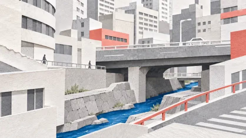
From Choryangcheon's reopened channel to Goejeongcheon's contested road space, decades of restoration work reveal how deeply Busan's rivers remain bound to the infrastructure around them.
In 2005, the official inventory of Busan's rivers included 2.3 kilometers of Choryangcheon, though none of that recorded length could be seen from the street. The stream had been covered along its entire course. It was also absent from routine water-quality sampling: the city's environmental survey placed it among seven fully covered rivers that could not be sampled under the survey arrangements then in use. Choryangcheon had not ceased to carry water, or to exist as a river in the administrative record. The ground above it had acquired other purposes, and the life of the channel had become difficult to observe.
Busan completed the reopening of 316 meters in June 2021, at a recorded project cost of 37 billion won. Daylight reached part of the former covered watercourse; a new public space took shape beside it. To maintain flow, however, the city also had to bring in groundwater discharged from the KTX Geumjeong Tunnel, transporting it through an engineered supply system. Removing the structure overhead and supplying the water below were distinct interventions, both essential to the restored landscape that emerged.
Measurements taken as the new supply began flowing showed that the channel was changing, although not all its ecological problems receded. A study by the Busan Institute of Health and Environment found that concentrations of biodegradable organic pollution fell after the new water began entering Choryangcheon, while aquatic invertebrate communities became more varied. The biological index rose at the restored reaches without lifting them out of its lowest health category. In a separate city survey in 2024, a Choryangcheon station again received the lowest grade, even though its streambed held the highest density of invertebrates among the survey's sampled sites. The densely populated streambed was still dominated by a community the index classified as severely degraded.
The changes along Choryangcheon cannot be understood within the 316 meters brought back into view. Across Busan, streams have been enlisted to carry stormwater beneath roads, accommodate parking and take the discharge of an expanding city. Some have been reopened; others remain beneath essential urban corridors. The condition of the water now flowing through them depends on sewers, pumps, land use and upstream pollution, often far beyond the reach of a restoration contract. What must be restored is consequently more complicated than the channel itself: a functioning watercourse inside a city built to use its space for something else.
When Streets Replaced Streams
Bujeoncheon's passage beneath Seomyeon records how urban development changed the purposes assigned to a river. A municipal retrospective published in 2015 traced its degradation to residential and industrial development from the 1960s, when domestic sewage and factory effluent entered the channel. In 1978, Busan covered 180 meters near the former Camp Hialeah to provide road space. Another 555 meters followed in 1980 through the central commercial area, and later works extended the covered route. The stream remained part of the drainage system, but the land immediately above it became part of the network carrying people and vehicles through a growing district.
By 1999, the city was describing the advantages and liabilities of river covering with unusual candor. During a November 1999 Busan City Council audit, a senior construction official reported roughly 35.2 kilometers of covering within the city's then 192.2-kilometer inventory of second-class local rivers. He cited inadequate roads, scarce parking and the demands of established neighborhoods. He also acknowledged that covering streams reduced their natural purification functions, worsened water quality and complicated inspection and maintenance. Plans for another 1,587 meters, largely intended to connect existing covered roads, were still under consideration. The additional surface space had carried a cost that could not be resolved by enclosing the water beneath it.
Busan continued to create covered channels even after environmental restoration had entered its river policy. During the early 2000s, the city was developing natural-style improvements along parts of Oncheoncheon while carrying out a separate covering project at Namsan-dong on the same river system. It also began removing a 650-meter parking area from the exposed riverbed near Sebyeonggyo. Clearing vehicles from an open channel was not the same undertaking as removing a roof over a buried one; each addressed different conditions. Those works proceeded in different stretches of the same river system, under different local requirements, while the city weighed ecological improvement against the space needed for roads and other facilities.
The development of sewer infrastructure altered the channels in a less visible way. Intercepting wastewater could keep pollution out of urban streams, but in heavily modified catchments it could also remove water that had become part of their ordinary dry-weather flow. In a November 2002 council hearing, the city's construction director described the resulting shortage of maintenance water and discussed sending treated effluent back upstream. Turbidity and odor were among the concerns. The same infrastructure that separated sewage from a river could leave a channel too dry to sustain the aquatic environment a restoration project was supposed to recover. That outcome depended on local drainage and groundwater conditions; it was not an inevitable consequence of sewer improvement everywhere.
Busan's 2005 environmental survey recorded 40.269 kilometers of covered channels within an inventory totaling 251.65 kilometers, with covering present on 23 rivers. The survey's definitions and river boundaries are historical. They cannot be used as a direct denominator for the city's 2025 register of designated river sections or converted into a current citywide covering rate without matching the actual reaches. What the figures establish is the substantial place covered rivers already occupied in the city's infrastructure. The consequences were never identical from one stream to the next. Some retained open, biologically active reaches upstream; others passed beneath roads and buildings over much of their recorded course.
Water from Elsewhere
The restoration studies at Choryangcheon and Daeyeoncheon addressed a problem already recognized by city engineers: depleted flow in channels whose surroundings had been extensively reworked. Choryangcheon received groundwater from the KTX tunnel at an average of about 4,000 metric tons a day during nine daytime hours. Daeyeoncheon drew instead on reclaimed water from the Nambu wastewater treatment plant, with a reported maximum supply of 8,300 tons a day over a twelve-hour operating period. The sources differed markedly. In their 2022 report, researchers at the Busan Institute of Health and Environment found that the groundwater entering Choryangcheon contained relatively little organic matter or nutrients, whereas the treated wastewater supplied to Daeyeoncheon carried substantially more nitrogen and phosphorus.
The measurements reflected those differences. At the downstream Choryangcheon station, average biochemical oxygen demand, or BOD, declined from 17.7 to 7.0 milligrams per liter after maintenance water was introduced. Total organic carbon fell from 8.6 to 3.0, total nitrogen from 11.641 to 6.430 and total phosphorus from 0.965 to 0.432. Daeyeoncheon's downstream BOD fell more sharply, from 15.7 to 3.1 milligrams per liter, but its total nitrogen rose from 2.282 to 11.638 and total phosphorus from 0.330 to 0.583. Both channels experienced improvements in the measured concentration of biodegradable organic pollution. Only one showed corresponding reductions in the nutrients reported here.
The same BOD decline. Different nutrient outcomes.
Downstream averages before and after maintenance-water supply. Each pair reads before → after, in mg/L.
CR3 / downstream station
Choryangcheon
KTX tunnel groundwater
BOD / biodegradable organic pollution
17.7 → 7.0 FELL
Total nitrogen 11.641 → 6.430 FELL
Total phosphorus 0.965 → 0.432 FELL
DY3 / downstream station
Daeyeoncheon
Nambu plant reclaimed water
BOD / biodegradable organic pollution
15.7 → 3.1 FELL
Total nitrogen 2.282 → 11.638 ROSE
Total phosphorus 0.330 → 0.583 ROSE
The divergent nutrient results matter for the aquatic communities each channel can support. Nitrogen and phosphorus support aquatic productivity, but excessive concentrations can encourage algal growth, particularly where water moves slowly. A favorable change in BOD does not describe every component of water quality; a concentration measurement, moreover, is not a measure of the total pollutant load moving through a channel. That requires information about discharge. For Daeyeoncheon, the added water improved some conditions while changing the chemical environment in others. Supplying a depleted stream with water, however carefully treated, introduces the characteristics of that source into the receiving ecosystem.
The surveys of organisms living on the streambed also recorded changes following the introduction of maintenance water, although the communities remained ecologically stressed. At two Choryangcheon stations within the restored reach, the average number of recorded benthic invertebrate taxa rose from three to eight and from four to eleven after maintenance-water supply. The Benthic Macroinvertebrate Index, a measure of ecological condition based on the organisms inhabiting the streambed, increased from 17.2 to 27.5 at one station and from 22.4 to 28.8 at the other. Both remained in category E, its lowest grade. An upstream Choryangcheon station retained a substantially higher index. The restored reaches supported a more varied community after the works and water supply, but a wide ecological difference between upstream and downstream remained.
Daeyeoncheon's restored stations also recorded greater taxonomic variety and improvements in diversity, although the abundance of organisms did not rise uniformly. Their BMI values increased from 18.7 to 25.5 and from 18.5 to 23.9, still within category E. At both rivers, the communities changed while their overall health category remained E. More taxa could survive without the channel acquiring the biological composition of a healthier stream. The survey followed the introduction of maintenance water over a short period in 2021, during works that also altered the physical channels. It was not an experiment capable of identifying the independent effect of removing the covering.
The 2024 biological monitoring report broadened the comparison. The institute examined 23 rivers at 29 sites; 27 received BMI grades. Two were rated A, nine B, five C, five D and six E. The Choryangcheon station near Hana Bank and the Daeyeoncheon site near Daecheon Elementary School were among those rated E, along with stations on Goejeongcheon and Gamjeoncheon. Daecheoncheon at Hwamyeong Bridge and Songjeongcheon near Osiria Station received the highest grade. Daecheoncheon had the largest recorded number of taxa, 38; Choryangcheon had the highest density, 6,122 invertebrates per square meter. A crowded streambed and a biologically healthy community are not the same finding.
Biological monitoring / 2024
A crowded streambed is not necessarily a healthy one.
Choryangcheon, near Hana Bank
Invertebrate density
6,122
individuals / m² · survey high
Ecological health / BMI
E
Lowest grade · very poor
Density counts organisms; BMI evaluates the condition of the biological community. These measures answer different questions.
The 2021 and 2024 figures came from separate sampling programs, and the exact alignment of their stations and survey conditions has not been established. The first survey documents changes following the new water supply; the second records the biological condition of selected sites three years later. Without a consistent time series, neither the course of recovery between those dates nor the specific contribution of daylighting can be isolated. The restored channel's living community reflects the water it receives, the habitat it offers and the pressures that persist throughout the catchment.
The Road Above Goejeongcheon
Goejeongcheon's recent history begins downstream of the covered road that the city now proposes to remove. In November 2017, the city completed improvements to roughly 671 meters of its exposed lower reach, widening the channel, removing contaminated sediment and building a walking route and viewing decks. Reporting from the completion ceremony by Yonhap News Agency found residents still complaining of odors and polluted water. City officials acknowledged the continuing influence of sewage arriving from upstream. Those complaints described the river in 2017, rather than conditions measured today. They revealed a lasting problem in the geography of restoration: the work was bounded by a construction corridor, but the water arrived from upstream.
The present plan concerns another stretch of Goejeongcheon, a 640-meter covered corridor through Hadan whose reopening is included in a program extending to 2028. At approximately 49.9 billion won, the proposed investment is substantial; its design has also had to account for the road and parking uses established above the river. Work on detailed design began in 2020, but consultations over replacement parking interrupted the process in 2021. Underground railway facilities required further discussion with the Busan Transportation Corporation. Revisions to the river master plan and successive engineering reviews followed. An earlier policy document referred to 1.27 kilometers within the design consultancy's scope, while the 640-meter restoration length was already present in the city's 2020 budget records. The difference cannot be treated as evidence that the construction corridor was later cut in half.
Removing the cover would also disturb the uses established above it. At a July 20, 2026 city council hearing, the city's environmental policy director described 199 on-street parking spaces and another 151 spaces in a public facility involved in the planning area. Replacement parking had not been secured, he said, and options connected to nearby redevelopment were under consideration. The figure of 350 described existing parking provision, not an approved number of spaces to be eliminated. It nevertheless showed why daylighting could not proceed independently of decisions about the traffic and commercial life already organized around the covered corridor. Restoring the river's surface would also redistribute space that the city had long treated as part of its transport infrastructure.
The administration consequently proposed changing the order of the works. Ecological maintenance-water facilities would be pursued before the cover was removed, while officials considered whether the eventual opening might be shorter than previously envisaged. Saha District's project record and 2026 procurement material describe a water-transfer main of approximately 3.1 kilometers from the Gangbyeon wastewater-treatment area, along with an intake pipeline, pumping equipment and additional phosphorus treatment. These are the components of a separate system, extending well beyond the 640-meter reach intended for physical restoration. They do not establish that treated water has begun flowing or that measured river conditions have improved. They do, however, show how the city's first practical intervention may change the water carried beneath the road before it changes the road itself.
Goejeongcheon / municipal works register
One river. Three different scopes.
The reported lengths concern separate reaches or infrastructure. They are not successive segments of a single opened river.
2017
Completed
Lower exposed reach
Channel improvements, sediment removal and pedestrian facilities. This stretch was already open to daylight.
671.2 m
Improved reach
Program to 2028
Planned
Covered Hadan corridor
Proposed cover removal, subject to urban-space and parking decisions. No completed reopening is established by the plan.
640 m
Proposed opening
2026 tender
Procurement
Water-transfer main
Construction-management tender covering a supply main, pumps and phosphorus treatment. Pipe length does not measure river opening.
3.1 km
Proposed main
There are practical reasons for addressing the water supply before disturbing the roadway. Increasing flow may relieve stagnation and improve the conditions under which pollutants are transported; additional phosphorus treatment may reduce one of the nutrient pressures associated with reclaimed-water supply. Neither measure supplies daylight, an exposed streambed or public access to a channel that remains covered. Conversely, the removal of the cover would not by itself repair defective sewers or guarantee enough water during dry weather. Goejeongcheon's earlier history gives the distinction particular force: the city has already improved a visible lower reach without thereby settling the condition of the water arriving from upstream. Its current program must contend with the river as both a hydraulic system and an occupied urban corridor.
In Seomyeon, the attempt to reopen Bujeoncheon ran into a different combination of road requirements and public funding rules. In 2015, Busan announced plans to reopen 850 meters of its covered course through Seomyeon by 2018, followed by another 550 meters by 2020. Those dates were targets, not records of completion. A decade later, the July 2026 council hearing heard a different account of the project. According to the environmental policy director, road traffic constraints had led planners to consider a two-level configuration, carrying stormwater in a lower channel while providing an ecological watercourse above. That concept was found ineligible for the national ecological-restoration assistance then available, and the funding framework later changed. The particular daylighting proposal was abandoned. The official's account explains the city's stated position; the original subsidy assessment and competing hydraulic designs would be needed to evaluate whether the concept was technically or financially justified.
Bujeoncheon's environmental works have since taken another form. A separate integrated river-planning initiative including Dongcheon continued to appear in municipal financial records, and Busanjin District issued a November 13, 2026 procurement notice for construction-management services associated with a nonpoint-source pollution-control scheme. The planned mechanical filtration installation had a stated treatment capacity of 6,000 cubic meters per hour. The 2.6-billion-won figure in the notice was the base amount for construction-management services, not the entire facility's construction cost. Nor was a procurement notice evidence that the installation had begun operating. Designed to treat pollutants transported by runoff, such a facility would address a different part of the water problem from either reopening the channel or maintaining dry-weather flow.
A separate city-commissioned investigation of 11 selected polluted urban streams, undertaken from 2025 into 2026, assigned about 78 percent of modeled BOD pollution loads to domestic sources and 21.3 percent to land-based sources within its study group. Those percentages are neither measurements of the entire city nor a count of faulty private sewer connections. Much of the pollution control needed to improve these rivers must therefore begin beyond their banks. Runoff treatment, wastewater interception and reliable maintenance water can make material contributions without opening a buried stream. The physical and public benefits of daylighting remain separate; so do the transport and flood-control obligations that may constrain it. The relative benefits of these measures will depend on the local catchment, the flood capacity that must be preserved and the urban functions occupying the channel.
Along the River, and Back to the City
The lower plaza beside Choryangcheon's reopened channel hosted public performances in 2024, bringing people to a place formerly occupied by a covered watercourse. Dong District announced the following April that plaza operations would be suspended for further construction, from April 14, 2025, until an anticipated date in December 2026. The schedule was expressly subject to revision; it does not prove that every adjoining walkway is closed today. The public use of the reopened reach thus acquired its own chronology, extending beyond the 2021 completion date and into subsequent construction and management.
Along Oncheoncheon, where riverside walking and cycling are already established, the practical problems lie elsewhere. Geumjeong District reported completing improvements to 370 meters of low-water revetment and walking facilities around Jangjeon Station and another 415 meters of path works around the Jangjeon and Busan National University station areas in June 2025. The district also acknowledged that the upper river's narrow cross-section limited opportunities to widen paths. These were works on existing facilities, not a verified increase of 785 meters in connected walkable riverfront. A well-maintained route is valuable, but its usefulness to nearby residents also depends on entrances, crossings, ramps and the points where a traveler can return to the surrounding streets. Those connections cannot be inferred from a construction length.
Flooding turns the design of an entrance into a question of escape. On September 20, 2023, a woman was swept away by a sudden torrent near Oncheonjang Station after becoming trapped at the riverside. Contemporaneous reporting based on police accounts and security footage indicated that she had approached an exit after an automatic flood barrier closed and appeared unable to locate the manual means of releasing it. The precise engineering circumstances and any subsequent changes to the equipment require a separate investigation. The reported sequence nonetheless underscores an essential requirement of a riverwalk: flood controls must protect people already inside the corridor, not only prevent new arrivals from entering it. Busan's fire services conducted multi-agency swift-water rescue exercises along Oncheoncheon in July 2026, rehearsing warning broadcasts, access restrictions and coordination. The exercise records preparedness, not proof of present safety in every location.
A river can also divide neighborhoods that have little need for another path along its banks. Busan completed the 254-meter Suyeong River Human Bridge in February 2026, linking opposite banks as a pedestrian route. Its completion cannot establish the walking time actually saved by residents or the quality of access from surrounding streets, but the project addresses a different public need from the reopening of a channel. The natural setting can also make unrestricted entry undesirable. Busan's 2024 biological survey found healthier communities at selected stations on Daecheoncheon and Songjeongcheon; those grades describe aquatic life, not the suitability of every bank for recreation. Public access must sometimes accommodate sensitive habitats and the inundation of floodplains as well as everyday movement.
Busan's draft waterfront management plan, announced in August 2026, seeks to bring the surrounding city into the discussion. Its planning frame covers roughly 400 kilometers of coast and 280 kilometers of river waterfront, extending approximately 500 meters inland from the water's edge. The figures indicate the scale of the proposed policy, not the amount of publicly accessible shoreline. Nor is the 280-kilometer planning estimate interchangeable with the length of designated rivers in a different legal inventory. Public access will be shaped instead by entrances, crossings, flood closures and the protection afforded to sensitive habitat, conditions that a planning boundary alone cannot establish.
The Work That Follows Completion
At Daericheon, the amount of water moving through the restored channel depends in part on the hours a pump can operate without disturbing the neighborhood. Between 2013 and 2020, Busan spent approximately 10 billion won on a restoration program that included channel improvements and facilities intended to deliver water from the Nakdong River. The system was designed to supply 9,000 metric tons a day. At a July 2023 council hearing, the city's environmental policy director explained that night operation had generated complaints about noise from water moving down the steep stream. Pumping had consequently been concentrated during daylight hours. He estimated actual delivery at roughly 3,000 to 4,000 tons a day—an oral approximation, not an audited meter reading.
The same official described a separate weakness in the sewer network. Some private properties remained unconnected to earlier sewage-separation works because their positions made connections difficult or owners had not agreed to the necessary work. Supplying additional water could help sustain the stream while wastewater from incomplete connections continued to enter it. The environmental condition of a reconstructed channel depended, in that account, on the hours a pump could run and on infrastructure outside the visible project. Neither constraint was settled by the recorded completion of the restoration.
The institute's 2024 water-quality survey recorded an improvement in Daericheon's BOD-based grade, from IV in 2023 to II in 2024. The separate biological survey still rated its benthic community D. At a November 2026 council audit, lawmaker Kim Jeong-won raised concerns over insufficient flow, stagnant water and odors, questioning what five years of monitoring had produced in practical maintenance. The council questions concerned continuing operations and nuisance conditions; they did not overturn the earlier chemical measurements. The chemistry, biological community, pump schedule and observed nuisance conditions belong to related but distinct records.
At Gamjeoncheon, attention has turned to pollution accumulating on the streambed. A 1.83-kilometer ecological restoration was completed in October 2020 under a program with a budget of about 25 billion won. In 2024, the institute reported higher and more variable BOD levels in association with stagnant sections. Deposits sampled at Eomgung 2 Bridge received the poorest sediment-pollution grade for organic matter and nutrients; dredging was undertaken in that area from late 2024 into early 2025. The result at one station cannot characterize every reach of the restored river. It nevertheless records an environmental burden that construction had not removed from the wider system. Subsequent changes would need to be assessed alongside the dredging itself, as well as rainfall, renewed sediment deposition and the pollutants arriving from the surrounding catchment.
The city has continued to commission post-restoration assessments. Its 2026 budget records a planned 2026–2030 monitoring program covering Dongcheon, Choryangcheon, Gamjeoncheon, Daericheon and Daeyeoncheon, at an aggregate planned cost of 1.35 billion won. The monitoring program continued alongside the council's November 2026 questions about whether earlier findings had led to better maintenance. The available public record does not yet reconcile five years of measurements at like-for-like stations with actual pump logs, sewer repairs, sediment works and operating expenditure. A sequence of commissioned surveys establishes observation; its contribution to recovery depends on the decisions that follow the results.
Busan's river-planning rules already require engineers to consider flood control, water use, ecology and surrounding communities. Along the rivers themselves, those responsibilities fall across different facilities, budgets and agencies. The open reach of Choryangcheon is sustained with water transferred from a railway tunnel; the road above Goejeongcheon cannot be removed without confronting the parking and infrastructure it supports; and the daily condition of Daericheon is affected by a pumping schedule negotiated against the noise of flowing water. Each project has a construction boundary, but none has an environmental life confined to it.
In 2005, Choryangcheon was one of the streams whose covered course could not be sampled under the city's routine survey arrangements. Two decades later, part of the channel is visible again, and researchers have begun to document the organisms inhabiting its restored reach. Visibility and biological recovery have followed different courses. The work that determines whether the two eventually converge will take place not only along its newly opened banks, but also in the pipes, sewers, control facilities and upstream neighborhoods from which the water comes.
Continue this reporting
Reporting on the same issue
Related coverage selected from the article's desk, topics and newsroom relationships.
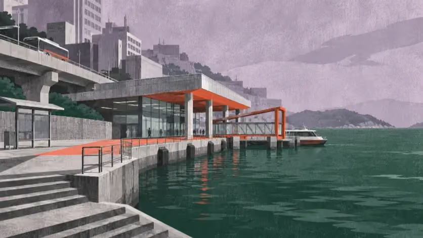 NewsNov 16, 2026
Busan’s Sea Taxi and the Economics of a Connected Coast
Busan’s planned sea taxi would link the Suyeong River, Gwangalli and Haeundae...
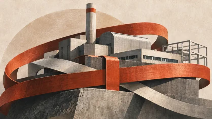 NewsNov 14, 2026
Who Pays to Host Busan’s Waste?
Busan’s Saenggok waste site has been shaped by relocation deals, recycling ri...
 NewsNov 11, 2026
The Cost Behind Busan's 10,000-Won Rent Promise
Busan's 10,000-won rent plan offers four months of relief, but reopening empt...
More from the author
More from this byline
Stay with the same line of reporting through more work from this byline.
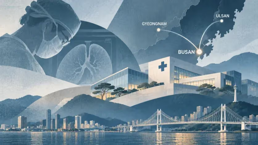 NewsNov 2, 2026
Where Busan’s Patients Go—and What Its Hospitals Can Provide
Reader Signal
Community readWhat did this report leave you with?
Choose the signal that best reflects your reading. Select it again to remove it.
One response per article
No response selected
A moderated conversation about the reporting.
One-level replies and newsroom moderation keep the conversation anchored to this article.
Discussion Status
Open
Please sign in to join the discussion.
Newsletter
Weekly reporting and context from Busan and Korea.