Is Busan’s 15-Minute City Reshaping How the City Moves
As Busan aligns itself with a global urban model, the durability of its transformation depends on measurable shifts in how the city moves.

BUSAN — Busan describes its urban strategy as a 15-minute city — daily life within reach, essential services embedded in neighborhood scale. The model, closely associated with Paris-based urbanist Carlos Moreno, is built on measurable shifts: declining car trips, rising public transport use, and access that does not depend on income or vehicle ownership.
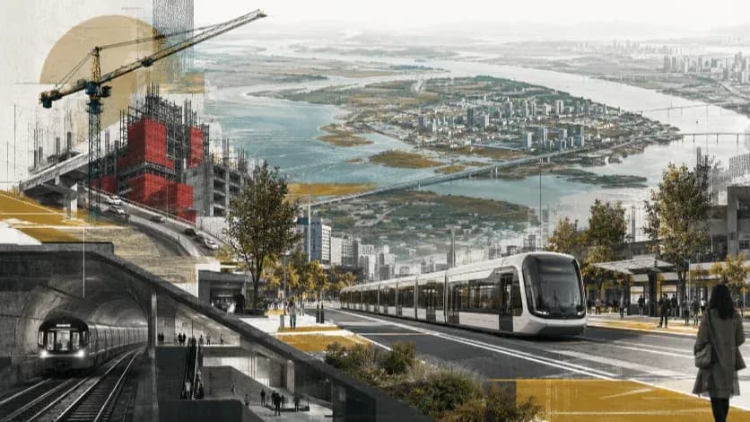
In Busan, the transformation is most visible in new neighborhood facilities — children’s centers, senior hubs, upgraded community infrastructure. These projects signal investment in proximity.
Yet the city’s physical structure complicates the equation. Mountain ridges separate residential districts from employment clusters. Key east–west corridors rely on bridges and tunnels, several operating under toll systems. For residents without private vehicles, travel times expand sharply beyond the fifteen-minute frame.
A 15-minute city is not defined by the presence of facilities, but by the redistribution of mobility itself — modal share, infrastructure spending, and the real cost of access. Whether Busan has begun that redistribution remains to be examined.
Mobility Before Branding
A city that claims proximity must first alter the way its residents move. The test does not begin with architecture or slogans, but with travel behavior. If the 15-minute framework has taken root, it should appear in the distribution of trips, in the relative dominance of transport modes, and in the direction of public investment.
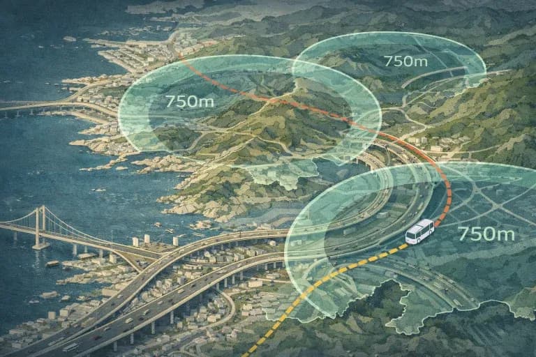
In Busan, the geography still dictates movement more than the policy does. The city’s long, narrow coastal form and its steep interior ridges funnel mobility into a limited set of arterial corridors. East–west travel converges on bridges and tunnels that compress the metropolitan network into a small number of high-capacity routes. These routes remain primarily structured around vehicular throughput.
For residents living in hillside districts, proximity is conditional. Access to major employment zones or commercial centers often requires descending through layered road systems before reaching transit hubs. The difference between a direct car trip and a multi-transfer bus journey can stretch well beyond the fifteen-minute threshold that defines the policy’s ambition.
A structural transition toward a proximity-based model would register in measurable rebalancing. Short car trips would decline as neighborhood services absorb daily demand. Walking and public transport would claim a larger share of routine mobility. Infrastructure spending would gradually favor access over speed. In Busan, however, the hierarchy of movement still appears to privilege vehicular continuity across fragmented terrain.
The tension lies not in the presence of new facilities, but in the persistence of the underlying network. Until mobility patterns reflect a redistribution away from automobile dependence, the 15-minute city remains a proposition layered onto an older transport logic.
Allocation and the Direction of Reform
Urban priorities reveal themselves in balance sheets long before they become visible in streetscapes. A city serious about restructuring mobility gradually shifts capital away from expanding vehicular corridors and toward strengthening everyday access. The transformation is rarely abrupt; it accumulates through the quiet redistribution of resources.
In Busan, road infrastructure remains a defining expenditure category. Maintenance, capacity upgrades, and corridor management continue to anchor transport investment. The metropolitan network, shaped over decades to secure east–west continuity across difficult terrain, still demands sustained funding to preserve its functionality. That legacy carries financial weight.
At the same time, the city highlights neighborhood-scale interventions as evidence of its proximity strategy. Community facilities, local hubs, and public space upgrades receive attention in official communication and urban branding. These projects are tangible and visible; they reshape daily experience at the micro level.
The question is whether micro-level enhancement is accompanied by macro-level reallocation. A proximity-based model does not only multiply neighborhood amenities. It gradually reduces the fiscal dominance of speed-oriented infrastructure and increases spending on walking networks, last-mile transit, and seamless modal integration. The scale of that reweighting determines whether the policy operates as structural reform or as an overlay upon existing systems.
In Busan’s case, the financial architecture of mobility still appears anchored to a corridor-based logic. Vehicular continuity across bridges and tunnels remains a strategic priority. Without a measurable tilt in resource distribution, the 15-minute framework risks functioning alongside, rather than within, the city’s core transport hierarchy.
Time, Cost, and the Price of Proximity
Proximity is often described in minutes. In practice, it is also measured in cost.
In Busan, cross-district movement depends on a series of bridges and tunnels that bind together a fragmented landscape. These structures shorten distance across water and mountain ridges, compressing what would otherwise be long detours. Yet several of these corridors operate within toll systems, embedding a monetary threshold into everyday mobility.
For drivers, the toll is folded into routine commuting. For residents without private vehicles, the equation changes. Bus routes rarely mirror the directness of vehicular corridors. Transfers extend travel time. In hillside neighborhoods, the descent to major arteries precedes any connection to high-capacity transit. The fifteen-minute radius contracts or expands depending not only on geography, but on mode and income.
A proximity-based urban model assumes equivalence of access — that daily needs can be reached without disproportionate reliance on private vehicles or paid shortcuts. Where fee-based infrastructure shapes the most efficient routes, accessibility becomes stratified. Speed is available, but not uniformly.
The presence of toll corridors does not invalidate a proximity strategy. It does, however, complicate its equity. If fifteen minutes is consistently achieved by car but rarely by public transport, the policy’s promise becomes conditional. The question is no longer whether services exist within reach, but who can reach them within the defined threshold.
In a city structured by terrain and corridor dependency, the cost of crossing space becomes inseparable from the concept of proximity itself.
Beyond Adoption
Urban strategies gain credibility not through affiliation but through measurable consequence. The language of proximity has travelled widely; its meaning depends on what shifts beneath it.
In Busan, the 15-minute framework sits within a city shaped by terrain, corridor dependency, and long-standing investment patterns. Neighborhood facilities have multiplied, and the rhetoric of accessibility has matured. Yet mobility hierarchies, fiscal weight, and cost structures remain influential determinants of how residents navigate space.
A structural transition would be visible in the ordinary patterns of daily movement — fewer short car trips, greater parity between modes, and reduced reliance on fee-based shortcuts for cross-city access. It would also be visible in the gradual redirection of infrastructure priorities toward seamless, low-cost connectivity.
The distinction between policy experiment and strategic branding does not lie in international recognition or in the presence of new amenities. It lies in whether proximity alters the city’s operational logic. If movement, spending, and access continue to follow established pathways, the 15-minute identity functions as an overlay. If those pathways begin to shift, the transformation becomes substantive.
The measure of Busan’s proximity strategy will ultimately be found not in its vocabulary, but in the everyday routes its residents take.
Editorial Context
"Independent journalism relies on radical transparency. View our full log of editorial notes, corrections, and project dispatches in the Newsroom Transparency Log."
Reader Pulse
The report's impact signal
Be the first to provide a reading pulse. These collective signals help our newsroom understand the impact of our reporting.
Join the discussion
A more thoughtful conversation, anchored to the story
Atlantic-style discussion for this article. One-level replies, editor prompts, and moderation-first participation are now powered directly by Prisma.
Discussion Status
Open
Please sign in to join the discussion.
The Weekly Breeze
Independent reporting and analysis on Busan,
Korea, and the broader regional economy.