Busan Reinforces West–East Transport Spine with New River Crossings and Tunnel Plan
Jangnakdaegyo launch, Eomgungdaegyo construction and the proposed Seunghak Tunnel consolidate a corridor shaped as much by geography as by policy.


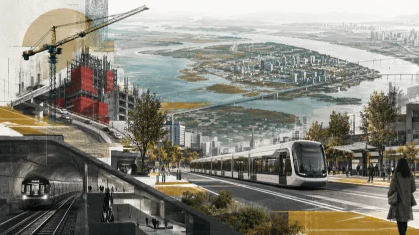
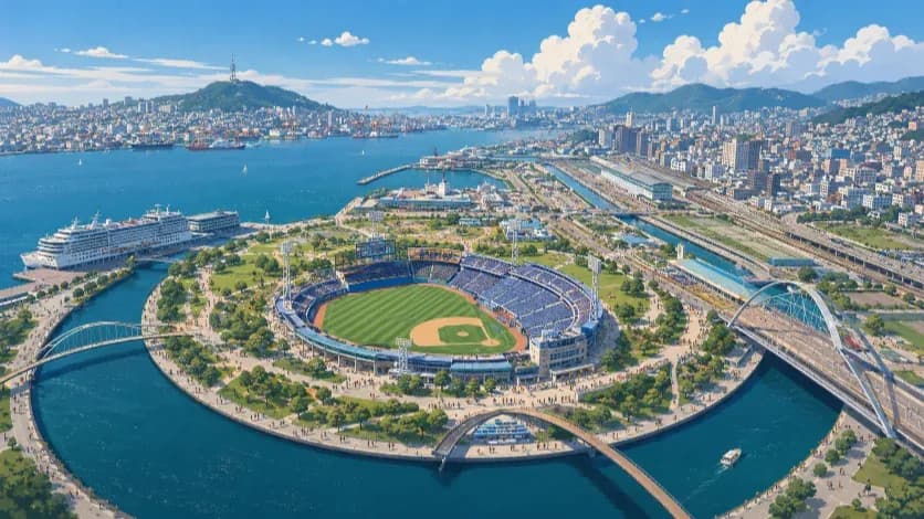
BUSAN — Busan on Monday formally launched construction of Jangnakdaegyo Bridge, a 1.53-kilometer, six-lane crossing over the Seonakdonggang River backed by a 163.6-billion-won budget and targeted for completion by 2030. The project adds new capacity between Saenggok-dong in the Busan–Jinhae Free Economic Zone and Myeongji-dong in Eco Delta City, two districts that have absorbed much of the city’s recent industrial and residential growth.
The bridge is not an isolated undertaking. Eomgungdaegyo Bridge, a 2.91-kilometer project with a total cost of 344.4 billion won, is already under way to connect Daejeo-dong in Gangseo District with Eomgung-dong in Sasang District. At the same time, the proposed Seunghak Tunnel — a 7.69-kilometer, 622.5-billion-won private-finance project — has cleared key procedural stages and would provide a direct underground link from Sasang toward Jung-gu near Chungjang-daero and the Busan North Port redevelopment area.
These projects align along a single west–east axis stretching from the Nakdonggang estuary through Gangseo and Sasang into the historic core. The concentration is not accidental. Busan’s expansion has long been shaped by terrain: the Nakdonggang River defines its western boundary, while mountain ridges including Seunghaksan and Baekyangsan restrict lateral road growth. Additional capacity tends to appear at the limited points where water and rock allow passage.
The current construction cycle reinforces that pattern. Industrial activity around the Free Economic Zone and housing expansion in Eco Delta City have intensified travel demand toward central Busan, even as redevelopment reshapes the North Port waterfront. Infrastructure investment is following the corridor those forces already define.
Expanding Crossing Capacity at the Nakdonggang
The most immediate impact comes from the river itself. For decades, movement between Gangseo’s western districts and the rest of Busan has depended on a limited number of Nakdonggang crossings. Traffic from logistics facilities, industrial complexes and newly built residential areas converges at those fixed points before dispersing toward Sasang and the central districts.
Jangnakdaegyo adds a new six-lane span across that barrier. By linking Saenggok-dong and Myeongji-dong directly, the bridge shortens routes between the Busan–Jinhae Free Economic Zone and Eco Delta City, both of which have expanded rapidly over the past decade. The project is designed less as a local connector and more as structural reinforcement for west–east movement.
Eomgungdaegyo serves a similar function further north. The 2.91-kilometer project, which includes two bridges and new interchanges, increases capacity between Daejeo-dong and Eomgung-dong, strengthening the connection between Gangseo and Sasang. Together, the two crossings alter the distribution of traffic along the lower Nakdonggang, adding alternative entry points into the city’s interior road network.
Further east, the proposed Seunghak Tunnel addresses a different constraint. While the river defines the western boundary, mountain ridges limit direct access from Sasang into Jung-gu. The 7.69-kilometer underground route would cut through that divide, reducing dependence on longer surface detours and linking the western districts more directly with Chungjang-daero and the North Port redevelopment area.
Each project responds to a specific barrier — water or rock — yet they align along the same corridor. The effect is cumulative: additional river capacity feeding into a new mountain passage, creating a more continuous west–east flow than has historically been possible.
Industrial Shift, Urban Redevelopment and the Reorientation of Demand
Over the past two decades, Busan’s economic center of gravity has moved westward. Container handling and logistics functions have concentrated around the New Port and the Busan–Jinhae Free Economic Zone, while industrial and distribution facilities have expanded along the lower Nakdonggang corridor. Gangseo District, once peripheral, now hosts a significant share of the city’s growth-oriented activity.
Residential development has followed. Eco Delta City is planned as a large-scale smart city accommodating tens of thousands of residents, adding commuter demand to freight movement already flowing toward Sasang and beyond. The daily pattern is no longer unidirectional toward the old downtown; it runs along multiple vectors connecting industrial parks, new housing districts and redevelopment sites.
At the same time, the historic core has been undergoing structural change. The Busan North Port Redevelopment Project has shifted portions of the waterfront away from cargo handling toward mixed-use development, public space and commercial functions. Road improvements around Chungjang-daero are designed to integrate that redevelopment with the existing arterial network.
These transformations have not produced a new transport geography so much as intensified pressure along an existing one. The main corridor linking the estuary through Gangseo and Sasang to Jung-gu has become the conduit through which industrial expansion, residential growth and waterfront restructuring intersect.
The current infrastructure program therefore reflects redistribution rather than expansion in the abstract. Traffic volumes are not simply increasing; they are being redirected along a tighter west–east alignment shaped by both economic relocation and physical constraint.
Geography as the Final Arbiter
Busan’s current wave of bridge and tunnel construction does not represent a dramatic policy pivot. It confirms a structural reality the city has confronted for more than a century.
The Nakdonggang River defines the western threshold of continuous development. Mountain ridges behind Sasang and Saha restrict lateral expansion toward the urban core. Within that frame, transport capacity cannot be diffused across broad frontage as it might be in flatter metropolitan regions. It must be inserted at narrow passages — across water or through rock.
Jangnakdaegyo and Eomgungdaegyo expand the river crossings. The Seunghak Tunnel, if completed as planned, would perforate the ridge barrier that has long separated Sasang from Jung-gu. Combined with road adjustments around Chungjang-daero and the North Port redevelopment area, these projects compress industrial growth, new residential districts and waterfront restructuring into a single west–east alignment.
The strategic question is not whether this corridor will strengthen; it already has. The more consequential issue is how traffic will redistribute once the additional capacity comes online. New crossings often reduce congestion at one node while intensifying pressure at another. Sasang’s interchanges and the downtown interface may become the next points of strain.
What remains constant is the city’s physical structure. Busan cannot expand indefinitely across its terrain; it negotiates with it. Infrastructure follows the paths geography allows, and economic activity settles along those lines. The emerging west–east spine is therefore less a product of ambition than of constraint — a reminder that in Busan, topography continues to arbitrate urban movement.
Editorial Context
"Independent journalism relies on radical transparency. View our full log of editorial notes, corrections, and project dispatches in the Newsroom Transparency Log."
Reader Pulse
The report's impact signal
Be the first to provide a reading pulse. These collective signals help our newsroom understand the impact of our reporting.
Join the discussion
A more thoughtful conversation, anchored to the story
Atlantic-style discussion for this article. One-level replies, editor prompts, and moderation-first participation are now powered directly by Prisma.
Discussion Status
Open
Please sign in to join the discussion.
The Weekly Breeze
Independent reporting and analysis on Busan,
Korea, and the broader regional economy.